Key Takeaways
|
Sewer inflow and infiltration (I&I) occurs when rainwater or groundwater enters sanitary sewer systems, increasing treatment costs, causing overflows, and reducing infrastructure efficiency.
For municipalities across the United States, managing wastewater infrastructure is becoming increasingly challenging as sewer systems age and maintenance costs continue to rise. Among the most persistent and expensive issues facing collection systems is Sewer Inflow and Infiltration (I&I), the unintended entry of rainwater or groundwater into sanitary sewers.
Although many utilities recognize that I&I contributes to excessive wastewater flows, locating where the extra water enters the system is often far more difficult than fixing the problem itself. Traditional inspection methods require significant labor, specialized equipment, and repeated field investigations while still leaving many defects undiscovered.
Today, advances in sensor technology, geographic information systems (GIS), digital modeling, and data analytics are changing how municipalities approach Sewer Inflow and Infiltration detection. Rather than relying solely on visual inspections or reactive maintenance, utilities can now use continuous monitoring and high-resolution data to identify problem areas more accurately, prioritize rehabilitation projects, and maximize maintenance budgets.
Understanding how I&I occurs, and why effective detection matters, is the first step toward improving wastewater system performance and reducing long-term operating costs.
What Is Sewer Inflow and Infiltration (I&I)?
Sewer Inflow and Infiltration (I&I) refers to clean water entering a sanitary sewer collection system through unintended pathways. While sanitary sewers are designed to carry wastewater from homes, businesses, and industries to treatment facilities, they are not intended to transport stormwater or groundwater.
Although often discussed together, inflow and infiltration describe two different types of water entry.
What Is Inflow?
Inflow is stormwater that rapidly enters the sewer system through direct connections or surface openings. Common sources include:
- Roof drains connected to sanitary sewers
- Yard drains
- Storm drain cross-connections
- Missing or damaged manhole covers
- Flooded manholes during heavy rainfall
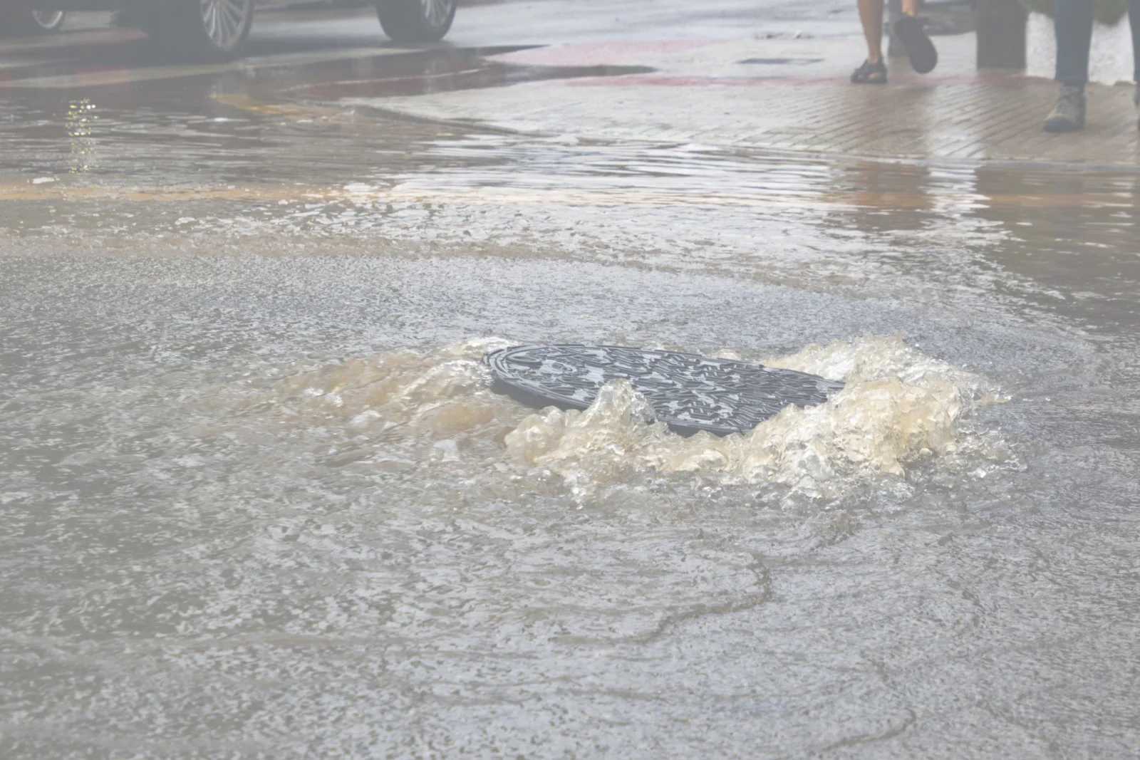
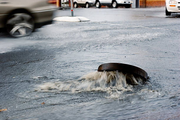
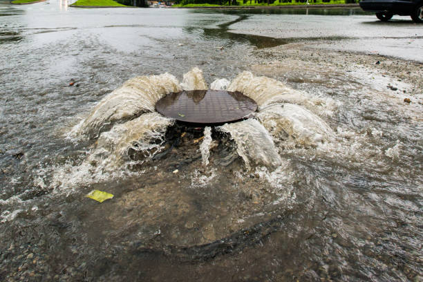
Because inflow enters quickly during rain events, wastewater flows can increase dramatically within a short period.
What Is Infiltration?
Infiltration occurs when groundwater slowly seeps into the sewer system through structural defects such as:
- Cracked sewer pipes
- Broken joints
- Deteriorated manholes
- Defective service laterals
- Aging infrastructure
Unlike inflow, infiltration can occur throughout the year, even during dry weather, depending on groundwater conditions.
Why Understanding the Difference Matters
Both inflow and infiltration increase the volume of water that wastewater treatment facilities must process. However, they often require different maintenance strategies and rehabilitation priorities.
Understanding whether excessive flow is caused by inflow, infiltration, or both allows municipalities to focus their resources on repairs that deliver measurable improvements rather than relying on broad, system-wide rehabilitation efforts.
Why Is Sewer Inflow and Infiltration Costing Cities Millions?
Inflow and Infiltration (I&I), extraneous water from sources like rain or groundwater entering sewer systems, is a significant and costly problem for municipalities. It can account for 35–50% of all treated wastewater, leading to overflows, increased treatment costs, environmental impacts, and public health threats. The main challenge isn’t fixing I&I, but finding its precise location.
While the additional water entering the collection system may appear harmless because it is relatively clean, it places significant strain on wastewater infrastructure. Every gallon of rainwater or groundwater that reaches a treatment facility consumes energy, labor, chemicals, and operational capacity that should be reserved for actual wastewater.
Higher Operating and Treatment Costs
Treatment plants are designed to process wastewater, not excess stormwater. When unnecessary water enters the system, municipalities spend additional money pumping, transporting, and treating water that never needed treatment in the first place.
For larger communities, these unnecessary expenses can amount to hundreds of thousands or even millions of dollars.
Increased Risk of Sewer Overflows
Heavy rainfall combined with significant I&I can overwhelm collection systems, increasing the likelihood of sanitary sewer overflows (SSOs). These sewage spills may release untreated wastewater into streets, waterways, or nearby properties, creating environmental concerns and potential regulatory violations.
Accelerated Infrastructure Wear
Pipes, lift stations, and treatment equipment experience greater stress when operating under higher-than-expected flows. Over time, this additional demand can shorten equipment life, increase maintenance requirements, and accelerate the need for costly infrastructure upgrades.
Reduced Capital Planning Efficiency
Without accurate information about where I&I originates, municipalities may spend valuable capital replacing pipes or rehabilitating assets that are still functioning adequately while overlooking the areas that contribute the most excess flow.
What Causes Inflow and Infiltration in Sewer Systems?
No wastewater collection system remains unchanged over decades of operation. As infrastructure ages and surrounding environments evolve, numerous defects can develop that allow unwanted water to enter the sanitary sewer network.
Aging Sewer Infrastructure
Many municipal sewer systems were installed decades ago. Over time, natural ground movement, corrosion, material deterioration, and repeated loading from traffic can weaken pipes and joints, creating pathways for groundwater intrusion.
Damaged Manholes
Manholes are frequent entry points for both inflow and infiltration. Cracked walls, deteriorated mortar joints, damaged chimney sections, and improperly sealed covers can allow rainwater and groundwater to enter the collection system.
Cracked or Broken Pipes
Structural defects such as fractures, separated joints, root intrusion, and collapsed pipe sections create openings where groundwater continuously enters the sewer system, particularly during periods of elevated groundwater levels.
Illegal or Improper Connections
In some areas, roof drains, sump pumps, foundation drains, or area drains have been improperly connected to sanitary sewers. These direct connections introduce large volumes of stormwater during rainfall events and significantly increase system flows.

Why Traditional I&I Detection Methods Often Miss the Real Problem
Traditional I&I detection methods like smoke testing, manhole inspections, and CCTV are often limited, labor-intensive, and only about 30% effective. They may miss subsurface leaks, are weather-dependent, don’t quantify flow, or require extensive public notification and confined space entry.
Smoke Testing
Smoke testing has long been used to identify direct inflow sources by forcing non-toxic smoke through sewer lines and observing where it escapes. While effective for locating obvious surface defects and illegal connections, it cannot detect groundwater infiltration beneath the surface or quantify how much water enters the system.
CCTV Inspection
Closed-circuit television (CCTV) inspection is one of the most widely used methods for evaluating sewer pipe conditions. Specialized cameras travel through pipelines, allowing inspectors to identify cracks, root intrusion, joint separation, corrosion, and structural defects.
Although CCTV provides valuable visual information, it has several limitations when used as the primary method for locating Sewer Inflow and Infiltration. A visible crack does not necessarily indicate that water is entering the system, while some infiltration pathways may remain hidden behind soil, debris, or active groundwater conditions. Utilities may also spend considerable time inspecting hundreds of feet of pipe without identifying which defects contribute the greatest volume of unwanted water.
Manhole Inspections
Manholes are another common inspection point because they provide access to underground sewer infrastructure. Inspectors evaluate structural integrity, identify cracks or leaks, and look for evidence of inflow during or after rainfall.
While these inspections are important, they often require confined space entry, traffic control, and extensive labor. Additionally, visual observations alone cannot measure the amount of water entering the system or determine whether a particular defect is responsible for significant infiltration.
Why Traditional Methods Have Limitations
Each traditional inspection technique serves an important purpose, but they typically provide only one piece of the overall picture. Municipalities often combine smoke testing, CCTV inspections, dye testing, and manhole inspections to investigate Sewer Inflow and Infiltration, yet these methods remain reactive and labor intensive.
Perhaps the greatest challenge is that most traditional investigations identify structural defects rather than quantifying how much each defect contributes to increased wastewater flow. As a result, utilities may spend valuable time and funding repairing assets that produce little measurable reduction in I&I while overlooking the locations responsible for the greatest losses.
This is why many municipalities are adopting data-driven monitoring technologies that prioritize repairs based on measurable flow data instead of assumptions.

How BASINiQ Pinpoints Sewer I&I Faster and More Accurately
BASINiQ, developed by RH Borden Smart Solutions, is a new, data-driven approach that identifies I&I sources 10–20 times faster than traditional methods.
- Digital Twin Flow Meters: The approach is built around the use of “Digital Twin Flow Meters.” These are a lightweight flow meter consisting of a radar level sensor combined with a millimeter accurate model of the manhole and HD 360° video inspection. Digital Twin Flow Meters allow us to calculate flow in a manhole and identify visible sources of I&I at scale and without confined space entry.
- Live Weather Integration: Near real-time flow monitoring is combined with high resolution precipitation data to show how increases in flow are correlated with increases in rainfall.
- High-Density Flow Networks: Digital Twin Flow Meters can be densely deployed with dozens or hundreds of sensors depending on the area to be analyzed. This high-resolution network allows for pinpointing I&I sources down to within a few hundred feet, or typically 1-2 manholes.
- Analytics: The data from the Digital Twin Flow Meters is combined with weather data on hydrographs to identify sources of I&I and differentiate between inflow and infiltration.
- Data Visualization: Results of the analysis are put on dashboards making all sources of I&I visible for decision makers and operators.
Key Technologies Behind BASINiQ
BASINiQ’s effectiveness stems from combining:
- Radar-based Level Sensors: These lightweight, accurate, and easy-to-deploy sensors can be installed without confined space entry and left in place for weeks or months (typically up to 5 months).
- Manhole Virtual Models (MVMs): High-resolution 3D lidar scans create a “digital twin” of each manhole. This precise geometry, when combined with level readings and Manning’s equation (an industry standard), allows for accurate estimation of flow and constitute the Digital Twin Flow Meter. This HD 360° video inspection is an added bonus provided with the I&I study.
- Precision Weather Tracking: BASINiQ integrates with the Baron Weather Network, a high-resolution service used by organizations like NASA and Garmin. It provides weather updates every half-mile, every four minutes across the U.S., enabling direct correlation between rain events and increased flow.
- GIS Dashboards: All data gathered and analyzed in the BASINiQ process is placed on a color-coded GIS dashboard. This makes sources of I&I immediately visible and allows decision-makers and operators to rapidly prioritize and understand the I&I in their system
Identifying I&I Signatures:
The system distinguishes different flow patterns to identify specific I&I types:
- Inflow signature: Characterized by a sudden spike and quick drop during rain events, often from surface connections like missing manhole lids or illegal roof drain hook-ups.
- Infiltration signature: Shows a more gradual rise and slow decrease, typically from subsurface issues like cracks in pipes or manholes, where groundwater saturates and seeps in. BASINiQ helps identify these persistent leaks that may affect systems year-round.
What Happens After I&I Is Located?
BASINiQ assessments can locate I&I within 60 to 90 days, drastically reducing the time it traditionally takes to achieve significant I&I reduction. This allows utilities to apply capital resources with high assurance of successful remediation.
Once high-priority locations have been identified, municipalities can make informed decisions about rehabilitation rather than relying on broad replacement programs. Repairs can be prioritized according to measurable impact, ensuring limited budgets are directed toward projects that deliver the greatest reduction in excess flow.
Accurate location data also supports long-term asset management. Utilities can verify the effectiveness of completed repairs, monitor changing conditions over time, and develop capital improvement plans based on objective performance data rather than assumptions.
This proactive approach reduces unnecessary spending, improves regulatory compliance, and helps wastewater systems operate more efficiently for years to come.
Building a Smarter Approach to Sewer Inflow and Infiltration with RH Borden
Successfully managing Sewer Inflow and Infiltration requires more than identifying visible defects, it requires accurate data, reliable analysis, and a proactive maintenance strategy. As municipalities continue to face aging infrastructure, tighter budgets, and increasing regulatory expectations, investing in technologies that precisely locate I&I can significantly improve operational efficiency and long-term infrastructure resilience.
RH Borden & Company helps municipalities transition from traditional, labor-intensive sewer maintenance to smarter, data-driven wastewater management. By combining sensor technology, AI-assisted analytics, digital modeling, and decades of field experience, the company enables utilities to make informed maintenance decisions that reduce unnecessary costs while extending the life of critical infrastructure.
Depending on each municipality’s needs, RH Borden offers a range of specialized services. Acoustic Assessments using SL-RAT technology help identify sewer lines that genuinely require cleaning, eliminating unnecessary maintenance activities. BASINiQ I&I Location Services provide high-density sensor monitoring that accurately pinpoints groundwater intrusion and inflow sources. Manhole Virtual Models (MVMs) create AI-assisted digital twins that support structural assessments and rehabilitation planning. Municipalities can also leverage the GIS Dashboard to centralize system information and implement Condition-Based Maintenance programs that prioritize maintenance based on asset condition rather than fixed schedules.
At RH Borden, we are committed to helping cities build smarter, more resilient wastewater collection systems through innovative technologies and actionable data. If your municipality is looking to better understand its collection system, reduce Sewer Inflow and Infiltration, or improve long-term asset management, our team is ready to help identify the right solution for your needs. Contact us now!

Frequently Asked Questions
How can I tell if my wastewater collection system has an inflow and infiltration problem?
Common warning signs include unusually high wet-weather flows, frequent sanitary sewer overflows, increased pumping costs, and treatment plants operating near capacity after rain events. Comparing dry-weather and wet-weather flow data is often the first step toward identifying potential I&I issues.
How long does it usually take to locate the source of sewer I&I?
The timeline depends on the size and complexity of the collection system. Traditional investigations can take many months or even years, while BASINiQ assessments can typically identify priority I&I locations within 60 to 90 days.
Can sewer inflow and infiltration increase wastewater treatment costs even if there are no sewer overflows?
Yes. Even when overflows do not occur, every gallon of stormwater or groundwater entering the sanitary sewer must still be pumped and treated, increasing operational expenses and reducing available treatment capacity.
How does accurate I&I location help municipalities prioritize rehabilitation projects?
Precise location data allows utilities to focus repairs on the areas contributing the greatest amount of excess flow. This improves return on investment, reduces unnecessary rehabilitation, and supports more effective capital improvement planning.
Is it possible to reduce I&I without replacing the entire sewer system?
Absolutely. Many municipalities achieve substantial reductions by identifying and repairing specific defects such as damaged manholes, cracked pipes, separated joints, or illegal stormwater connections. Data-driven investigations help target these repairs without the cost of large-scale system replacement.
