

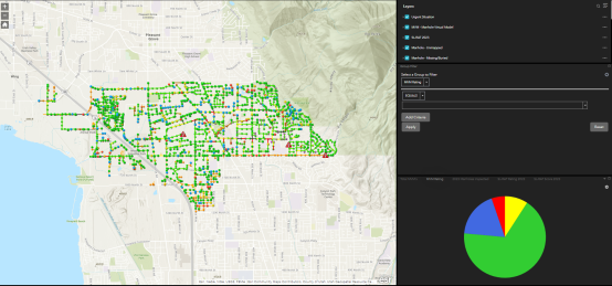

The SL-RAT is helping us to support the rapid growth of our collection system.
Mack Straw

The SL-RAT service has improved our maintenance program, cut actual costs, and given us much more confidence and trackability concerning the condition of our system.
Jared Hancock

This new technology does appear to be valuable in reducing the City’s labor costs by reducing the regular practice of cleaning pipes that may not need to be cleaned... So far this means a reduction of cleaning responsibilities by 10X!
Chuck Gillette, P.E.

Due to the success of acoustic assessments in our city, we are in the process of updating our SSMP to incorporate this into our annual plan for collection system maintenance.
James Thomas

This is the most amazing device I have seen in 40 years! We can now assess our entire system every year for less than what we were spending to maintain a third of it.
Wade Eva

Great experience

Great to work with, he very informative and responsive. RH Borden has impressed me with their customer service and support.

Does what it was avertised to do
Paul Swainston

RH Borden has managed the line and manhole assessment very well. The information is very helpful and saves us time and money.
Joe Hawkes
RH Borden has been great to work with we appreciate everything they have done thus far.
Cobe Evans

We are excited to take advantage of this new technology.
Don Stonebrink

Well worth the money, we’re very happy to be a customer!
Kirk Medina

Working with RH Borden has been exciting, the services they have provided to our city are just what we needed. Would highly recommend them.
Donald Keesler

They were very professional and stayed in contact with the process and results of the job.

Great customer service and we are excited to understand the condition of our system and use this as an asset management tool.
Ted Mickelsen

They have been a great company to work with and very communicative.
Ashton Baker

RH Borden is very easy to work with, very thorough, actionable data at my fingertips.